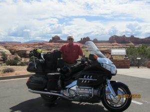
 I made it, I’m in Canyonlands National Park in Utah. The ride over from Grand Junction, KS was only two and a half hours. Once in Utah, there weren’t many gas stations or services. Even though I wasn’t low of fuel, I stopped at the first one I saw to use the restroom and buy ice. When walking in from the gas pumps I was side by side with an elderly gentleman—probably an 80-year-old.
When we got to the door, I said, “Go ahead.”
“No,” he said, “after you.”
“No please, go ahead.” And he did. Passing the cashier, he told her, “I’m just going to use the restroom.” Then he looked at me and understanding that was my intent as well, said, “Please, go ahead.”
“No,” I said, “please, after you.” And he did.
We met again by the gas pumps. The pickup he was driving had a plaque on the front bumper that read “#1 Grandpa.”
I pointed to it and said, “I thought I had been given that title.”
He smiled and said, “I guess not. I got the plaque. You must be #2.”
We both laughed and waved goodbye.
My first order of business in Canyonland Nation Park was to find the campgrounds and hopefully find a site. It was the weekend and there were many visitors. I was planning to spend two nights here. When camping at Yellowstone and also Glacier, the campgrounds all had restrooms and available wifi. Not so at Canyonlands. The campgrounds, small and few in number, had a picnic table and that was it. No restrooms, no water, and no electricity. There were three camping areas and one, according to the visitor’s center, was already full.
Because it was still early, I was able to get the last available site in one of the others. It’s a lovely site on a bluff overlooking a vast canyon. There is no shade and the rocky ground posed a challenge getting my tent staked down. That was important because it was very windy on that bluff. I used rocks to hold the corners of the tent in place. I was also surprised at how much huffing and puffing I was doing setting up the tent. Later I discovered elevation was 6,000 feet, significantly thinner air than in Indiana.
Canyonlands NP has two halves. The northern half where I was, is referred to as “Island in the Sky,” because all the terrine looks down into the canyons. The southern part, called “Needles” is at the base of the canyons and you look up at the towering buttes. My plan is to visit the vistas in this northern section this day and then tomorrow visit the needles. Canyonlands is Utah’s largest NP. It’s a four-hour round-trip to get there so tomorrow I’ll leave early, do my touring and return to my bluff site for one more night. At least that’s my intention.
After Canyonlands, my plan to head off toward Bryce Canyon, another Utah National park.
The visitors center in the northern Canyonlands is the only place to find water. I stopped and filled every container I had to use later for my freeze-dried dinners and coffee. The roadway through the park describes a big “Y” in configuration, about 20 miles in length. Along the way are marked hiking trailheads and scenic overlooks. I didn’t plan to do any hiking but was looking forward to the scenic views.
This area was designated a National Park in 1964. Prior to that the land was inhabited by ranchers who struggled to scratch out a living on its barren ground and inhospitable weather. In the 1950s rumors of Uranium and oil deposits generated some mining interests. One miner, Charlie Speen from Texas, did discover Uranium which launched a boom period. Signs of mining roads and blasting sites are still evident, but no other miners were successful, and the area was abandoned.
Shafer Canyon Overlook was spectacular. From the lofty viewing height, you see dramatic canyon depths far below. You could also see the Shafer Trail the ranchers used to drive their cattle to more favorable grazing areas in the spring and the fall.
At the Green River Overlook you can see the Green River bed that meets up later with the Colorado River. John Powell, a one-armed Civil War veteran, explored these parts in 1869 and described the area as strange and weird with rock and buttes towering hundreds of thousands of feet, impossible to scale, which shrink the river into insignificance.
The canyon road ends at the Grand Point View Overlook. It’s a vast sight. On a clear day like this day, you could see 184 miles distant to the La Sol mountains to the north. Also seen below is the totem rock formation reaching 305 feet in height and marveling spectators that it’s seemingly pencil-thin dimensions have withstood thousands of years of storms and high winds.
How is it these spires tower hundreds of feet above the surrounding terrain? The answer goes back 32-million years when this part of the earth was covered by a sea. Over the ages the sea evaporated, and the sea bed made up of various rock structures eroded. The sandstone receded whereas the hard granite remained. This geography continues to change. Water still seeps into the cracks and crevices of the tall buttes and freezes in the cold winter months. When the ice expands huge boulder chunks, some the size of houses, break loose and roll into the canyons below.
The next morning, after wondering if the night winds were going to carry my tent and me away, I awoke early and headed off on a two-hour trip to the Needles in the southern part of Canyonlands. Thirty minutes into my ride, it occurred to me what a dumb plan it was. Two hours down, three or four hours touring, then two-hours back. And the following day, I would again be heading south toward Brice Canyon, why not have my tent and equipment with me and avoid those four hours retracing my steps? I’m not stupid, just a little slow to get things figured out sometimes. So back to the campsite, repacked my gear, and headed south.
Needles was fascinating. Surrounded as I were by towering walls, it was like driving down the avenues of skyscraper cities. Some of the mammoth boulders that broke from the lofty heights are lying on the opposite side of the road. Whether that happened eons before the road was built or more recently is not known.
As awed as I was by the sights around me, I was feeling very weary. Not having had a shower in 48 hours and needing recharging of cell phone, computer, and camera, I was thinking a Motel 6 might fit the bill nicely. The town of Monticello was only 50 miles away and looked on the map to be a size that might offered recharging opportunities, both high-tech devices and moi.
Topping off at a gas station a trucker offered to give me his rig in exchange for Rosie and my travels. I had a similar offer in Nevada a few years back. A young man approached at a gas station saying, “I’ll give you a wife and two kids for the trip you are on.”
Sorry, guys. This may be the end of an affair, and I’m going squeeze out every last ounce of enjoyment out of it. Now, time to recharge.
Thanks Jim. Brings back many memories of my former life with a man who always picked the blue lines or even some that were only seen with a magnifying glass! For 15 yrs…every summer…with 2 complaining boys. A different route every time but ending up in a great little town every time in Montana. LOVED THOSE SUMMERS!! Be safe! ? & Me
David & I are enjoying this trip so very much Jim. Happy to be along. Safe travels and write-about rich experiences.Heather S.
I feel as if I’m back there, Jim. Well done, but you might want to reconsider that offer to swap for an 18 wheeler. Build in bedroom, and I can easily envision you tooling down the interstate behind the wheel of a Peterbilt. ~pfa
Hi, Jim. Sure enjoying go along with you on this trip.
Bob Irvine
I got it.